25/06 – 27/06: Waterfalls, Hairpins & Houses Under Cliffs
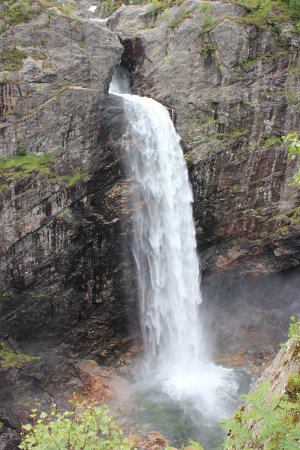
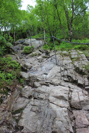
After leaving Preikestolen, we headed towards Lysebotn. En route, we stopped at the Månafossen waterfall (turn off route 45 between Dirdal and Byrkjedal. The walk only takes about 20 minutes but it is steep and rocky:
It was a pleasant diversion, after which we rejoined route 45 and continued towards Lysebotn. Our original plan was to drive around (down the 27 hairpin, 1000m drop to Lysebotn) before taking the ferry back to Lauvik. Two ferries serve this route, a regular, year-round service which is small and fast but requires pre-booking, and a summer-only tourist ferry which is large and slow. Both are costly, especially the tourist ferry, which we estimated would cost £60-£70 for us. We decided to abandon this plan and instead head back up the road from Lysebotn and then take route 468 south towards Egersund, our next destination.
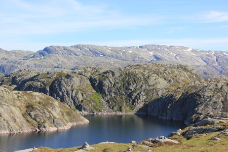
The drive to Lysebotn is very scenic, but by far the best bit is the drive across the mountain plateau before you start the descent to Lysebotn. The much-touted 27 hairpin bends do not offer as good a view as you might expect, and the Lysefjord remains almost invisible the whole time. Lysebotn itself is popular place for base jumpers to congregate before they jump off nearby bases, but other than the ferry port and the offices of a hydroelectric power installation, there’s nothing there.
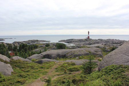
Leaving Lysebotn, we retraced our route as far as Svartevatn, on route 45, where we took route 468 south to Tonstad, followed by the 42 south west towards Egersund. Instead of arriving in Egersund, we headed down to Eigerøya, a small island south of Egersund that’s connected to the mainland by a causeway. Here, we walked out to the lighthouse, admired the magma rock formations (www.magmageopark.com) and spent the night.
Egersund proved a pleasant enough town, with ample free parking, and after a wander and a bit of shopping at our favourite Norwegian supermarket (Kiwi Mini Pris), we moved on slowly towards the even more pleasant town of Flekkefjord, where we spent the night by the marina. En route from Egersund to Flekkefjord are a couple of Norwegian photo opportunities that appear on many postcards and tourist brochures.
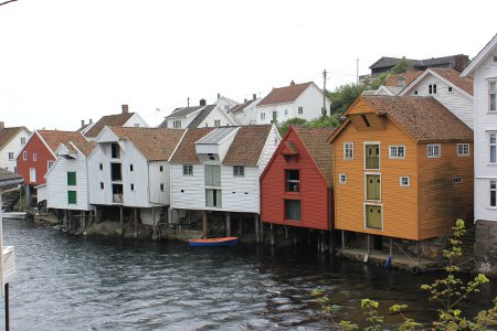
The first, signposted Sogndalsstrand from the main road (44) is a very picturesque fishing village that’s chock full of timber houses and very well preserved. It is an exact analogue of Robin Hood’s Bay in North Yorkshire but much more picturesque. Free tourist parking is provided on the outskirts of the village, from where you can walk in. Sogndalsstrand is much more worthwhile than the much-touted Henningsvær further north. The main photo opportunity is of a row of traditional timber houses sticking out over the fjord on stilts. To see this shot as the tourist board pictures it, cross the bridge you will find about halfway down the main street, then look to your right.
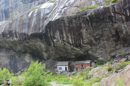
Next up on the photo opportunity list was Helleren. Helleren is actually a generic term for houses which were built under overhanging cliffs to take advantage of the shelter they offer from the weather. This example (again, signposted from the main road) is of two fairly well preserved 18th century timber houses that nestle under the cliff at the foot of the Jossingfjord.
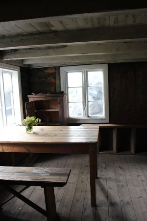
The nearby titanium mining facility (I think that’s what it is) somewhat spoils the view nearby and creates an odd smell, but despite this, these houses are worth a visit if you are passing. Take the standard tourist brochure photo from the parking area and then follow the footpath across to take a close look at the houses – they are open all year round and can be freely explored. Each has a visitors’ book.
Judging from the photo exhibit inside one house, they were lived in until at least 1916 – and the remains of extremely old electric wiring suggests it could have been slightly later.
