10/06 – 14/06: Knivskjelodden & The Midnight Sun
Heading north from the island of Senja, we rejoined the E6 and begin the journey to Magerøya Island, home to mainland Europe’s most northerly point (despite the fact it’s an island!). Contrary to popular belief, Nordkapp (the North Cape) is not the most northerly point – it’s just the most northerly point you can drive to. If you are fit and willing to hike, you can get further north, to Knivskjelodden; this was our plan.
As you head north, the scenery alternates between very bleak and forested – but even a small change in altitude is enough to remind you how far north you are and the Arctic wind gradually often adds an impressive wind chill, even on mild early summer days.
Access to Magerøya Island is via toll tunnel – click here for the tunnel website (Prices are under ‘Priser’). Our sub-6m van plus one passenger cost 192Nkr each way in June 2011.
Getting To Knivskjelodden
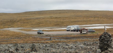
Our ultimate destination was not the tourist mecca of the Nordkapp Visitor Centre, but Knivskjelodden (71 degrees, 11 mins and 8 secs north), the true most northerly point in Europe. This is reached on foot from the Jalgavarri car park, which is free and is situated directly off the E69, just south of the Nordkapp visitors centre. The walk to Knivskjelodden is an 18km (12 mile) round trip and it is fairly rough, but not difficult going. In early June, we found mud, snow and a cold wind – dress as you would for a long walk on an English winter day.
The path is clearly waymarked with cairns and red painted ‘T’s on rocks. For much of the walk you can see the distant Nordkapp Visitor Centre on the top of its cliff, although this does disappear into the clouds occasionally. This walk is at a lower level and we did not experience any visibility problems, although it’s clear that the weather could change fast.
The walk starts from the back of the Jalgavarri car park, at right angles to the road. Follow the way markers up to the top of the first hill and then onwards, passing through a glacial valley and eventually along a rocky beach to the finish line, Knivskjelodden.
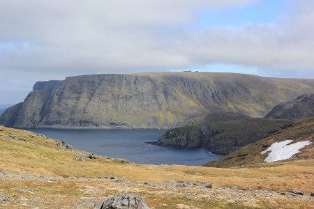
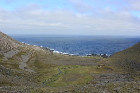
The true most northerly point in Europe is marked by a small obelisk and there is a metal locker nearby, which houses a walkers’ logbook. We found we had arrived just a few days after Adam and Sophie of Europe by Camper – it’s a small world. (The four of us were the only Brits in the book this year – how come so many more Germans, Dutch, French, Swiss and Italians visit Norway than do us Brits?).
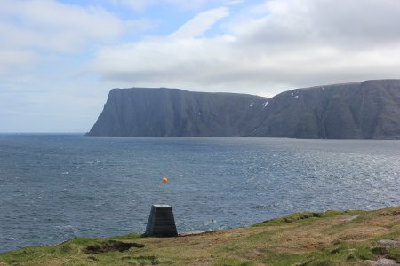
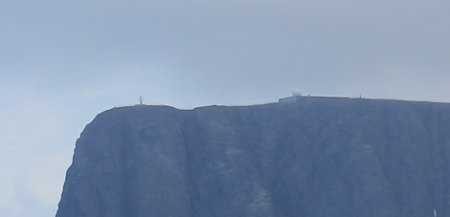
The walk from Jalgavarri to Knivskjelodden offered impressive views and was very satisfying – we were very pleased to have chosen this option. The return trip took us 5.5 hours, with a half hour stop for lunch.
You could overnight in the car park at the start of the walk, but it is exposed and in a pretty bleak location. A good alternative, if you have the time to drive before or after your walk, is to park in one of the two large rest areas situated at sea level in large bays en route to Nordkapp, after you have passed through the undersea tunnel to Magerøya Island. We stayed in the second of these and it was ideal, although the drive to the Jalgavarri car park took 1.5 hours.
After leaving Nordkapp and Magerøya Island, we would have liked to continue east to the far reaches of Norway and the Russian border. However, time didn’t permit this and we headed south again, back down the E6. We did take one further sidetrip, to Hammerfest, where we hoped to see the midnight sun.
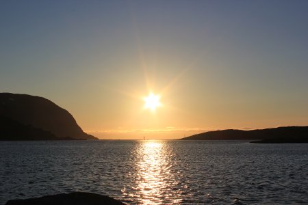
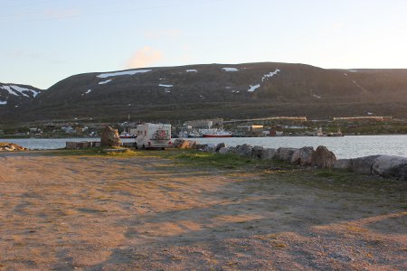
Now, I think this is a bit unecessary – I know the sun is still up at midnight because it’s still bright daylight. However, many people, some of whom are close to me, like to actually see the sun. As it happens, we found the perfect place to observe the sun against a clear horizon and to park overnight, just beyond Hammerfest, near the village of Forsøl – here, in fact (head out to Forsøl and then follow the sign ‘Kulturminner’.
Note: If you are not much of an astronomer, you may not realise that in the Arctic Circle, the sun does not just go up and down in midsummer – it goes sideways, too. This is how it manages to remain above the horizon in the west but then appear above the horizon in the east in time for morning. If you look at the map I’ve linked to above, you will not that the view is more or less to the north, not to the west!
We had to hastily reposition ourselves when we realised this but managed to get a bona fide midnight sun shot, as you can see:
Hammerfest itself has undergone lots of redevelopment over the last decade or so but is still an utterly pointless place to visit, unless you happen to need the facilities of a medium-sized town or harbour. It’s not an unpleasant place, but there just isn’t really any point in going there.
Two days of hard driving later (Norway is a big country), we were within spitting distance of Trondheim and ready to begin the second half of our Norwegian tour.
