02/06 – 05/06: Jotunheim NP, Roros & The Arctic Circle
We arrived in Larvik on the Hirtshals-Larvik ferry. We drove into Larvik intending to try and buy a PAYG Telenor SIM for our mobile broadband dongle, but every shop in the town was closed, barring an ice cream stand, so we bought an ice cream instead. I think it may have been Ascension Day (40 days after Easter, for the atheists amongst us).
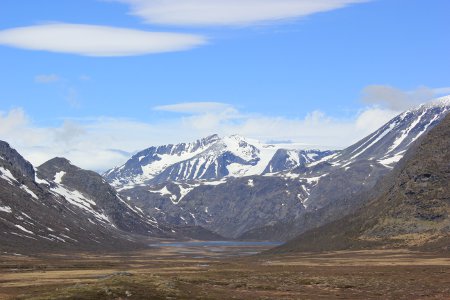
Abandoning that plan, we hit the road and headed north up the E8/E16 towards Fagernes and Route 51, one of the main roads through the Jotunheim National Park. This is a good drive and very scenic. ‘Jotunheim’ means ‘home of the giants’ and the park is Norway’s most popular hiking location, with good reason. It’s home to Norway’s two highest mountains (Galdhoppigen, 2,469m and Glittertind, 2,464m) and the country’s highest waterfall, the 275m Vettisfossen. The park is alpine in scale and just as beautiful – well worth a drive though at least.
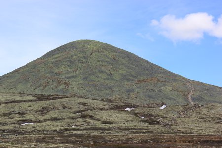
From there, we took the E6 to the south east and then turned north onto Route 27, the main road through the Rondane National Park. This is less impressive than the Jotunheim NP but its poor soil means that lichens predominate as ground cover, giving rise to the odd sight of whole hills covered in lichen. It is a surprising contrast to the Jotunheim NP and is a worthwhile drive.
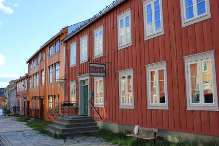
From Route 27 at Folldal, we took Route 29/30 to Røros, a town which has UNESCO World Heritage status thanks to its preserved copper mine and old wooden houses, some of which are 300 years old and have traditional grass roofs. Copper mining was the primary industry in Røros from the 17th century until the mid-1970s, when the final mine closed.
The mine’s remains and the associated houses provide a real taste of how much Norway has changed – the old town has a frontier-town feel that is reminiscent of Soviet-era rural towns or 19th century American mining towns like Durango. Norway’s more rural areas were once dotted with resource towns such as these and the change that is evident today highlights how the country’s economy has prospered thanks to the ultimate 20th century resource, oil.
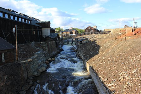
Røros is regulary used by film companies – according to our Rough Guide Norway, it was used in 1971 to film parts of Alexander Solzhenitsyn’s One Day in the Life of Ivan Denisovich, which gives you an idea of the character of the old town. You can also pay to walk around the mine museum (in the old mine buildings) and the slag heaps, but we didn’t.
From Røros, our route took us towards Trondheim, where we joined the E6 to put in a good stint going north towards Bodø, ferry gateway to the Lofoten Islands. Our plan was to see the north of Norway first and then explore the south and west in the second half of our trip. The weather turned bad for a day, with high winds and driving rain and you really got a feel for how far north you were – Mo i Rana was particularly grim, although it is a good place to fill up with fuel; the Shell filling station has a free motorhome service point.
We also visited the Rema 1000 supermarket to top up with fresh stuff and get our first taste of Norwegian food prices. We didn’t buy any nectarines as they were £5 for 4 – our local market at home was selling them 3 for £1 when we left home. Bananas, apples and pears were not too bad, though and bread was only about twice what Tesco charges.
Our observations throughout our time in Norway suggest that north of Trondheim, many motorhomers stick to the E6, presumably in a bid to get to Nordkapp and back as quickly as possible. Stephen Stewart’s description of it as a ‘campervan racetrack’ is not far off. The E6 is useful and provides many hundreds of miles of spectacular views, but if you have the time then it is worth taking loops away from it to see some of the best scenery, as we now did.
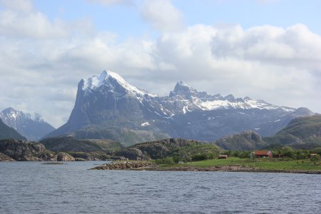
Leaving Mo i Rana, we headed west on route 12, towards the coast and our ultimate destination of Bodø. After spending the night in a layby on this road, the weather miraculously improved and we were privileged to enjoy an early June day of perfect weather as we headed up route 17 along the coast (via two ferries, which cost NoK202 (1 hour) and NoK 86 (10 minutes) respectively. These ferries are an integral part of the road network along the coast of Norway and although they may seem expensive at first glance, there are usually no viable road alternatives.
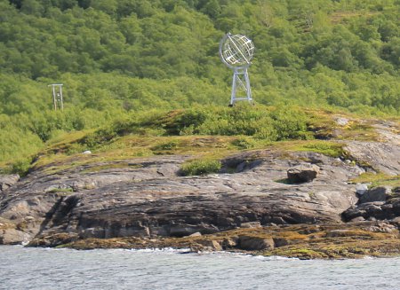
In this case, the longer ferry ride, from Kilbognhamm to Jektvik, was one of the highlights of the day. We spent an hour at sea, during which time we crossed into the Arctic Circle (there is a globe on the shoreline to mark the spot and it is announced on the tannoy) and enjoyed some stunning scenery from a point of view that no road could provide.
